Yukon Warns of Elevated Spring Flood Risk as Above-Average Snowpack Threatens Teslin, Carmacks, and Klondike Valley Homeowners
Four Canadian Regions Now Flagged for Spring Flood Risk This Month — and the Insurance Gap Remains the Biggest Threat Most Homeowners Don't See Coming
By
Published: March 27, 2026
Credit: Shutterstock
Key Takeaways
•The Yukon government has flagged Teslin, Carmacks, Upper Liard, and the Klondike Valley for elevated spring flood risk, with snowpack in the Teslin/Big Salmon basin sitting at 153% of normal — roughly three-quarters of the level that caused significant flooding in 2022.
•This is now the fourth distinct Canadian region flagged for elevated spring flood risk in March 2026, joining Ontario, Manitoba, Atlantic Canada, and British Columbia — making this a national preparedness moment, not a regional news story.
•Overland flood coverage is still an add-on in most Canadian home insurance policies, and a recent survey found 30% of homeowners don't realize it's not included by default — the window to verify and secure coverage narrows once flood warnings are active.
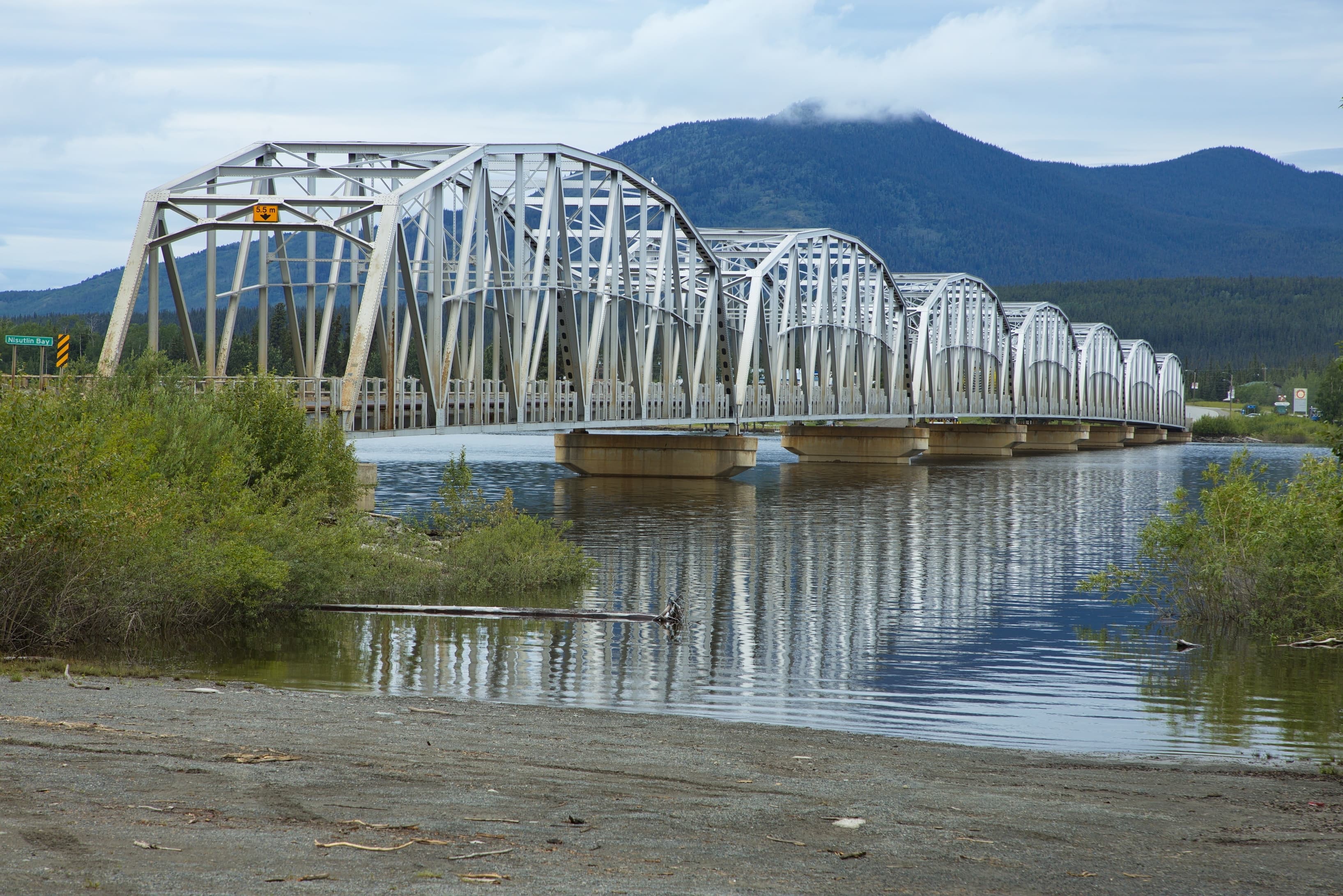
The Yukon government issued a spring flood advisory on March 23, warning that four communities face elevated flood risk as well-above-normal snowpack sets the stage for a potentially dangerous freshet season. Teslin, Carmacks, Upper Liard, and the Klondike Valley are the named areas of concern, with the Teslin/Big Salmon basin carrying the highest snowpack in the territory.
The advisory itself is straightforward. What makes it significant for homeowners across Canada is the pattern it reinforces: Yukon is now the fourth region flagged for elevated spring flood risk this month, after Ontario and Manitoba, Atlantic Canada, and British Columbia. The consistent thread across all four advisories is the same: high snowpack, a cold spring delaying the melt, and a forecast shift to warmer conditions that could accelerate runoff over a compressed window. The readiness steps Yukon's Emergency Measures Organization is recommending — clear drainage paths, test sump pumps, elevate basement contents, verify insurance coverage — apply to every Canadian homeowner watching the same weather pattern unfold.
Stay on top of Canadian homeowner news
Advertisement
What the Yukon Advisory Says
The Four Flagged Communities
The March 1 Yukon Snow Survey Bulletin provides the data underpinning the advisory. Snowpack across the Teslin/Big Salmon, Central Yukon (Carmacks area), White River, Liard, and Lower Yukon (Dawson/Klondike) basins is classified as well above normal. The Upper Yukon basin, including the Southern Lakes and Whitehorse area, is above normal but with more conditional risk — flood potential there depends on the timing of snowmelt, summer precipitation, and glacial melt.
The Teslin/Big Salmon basin is the most concerning. The bulletin estimates basin-averaged snow water equivalent at 248 millimetres, or 153% of the long-term normal, with cumulative winter precipitation in Teslin running at 170% of normal. These are not marginal increases. They represent substantially more water stored in the snowpack than the territory typically manages through the spring freshet.
Marsh Lake is the exception. Average snowpack combined with below-average groundwater levels gives the lake ample capacity to absorb spring inflows, and flood risk there is considered low.
The Weather Trigger
Environment and Climate Change Canada expects April to be colder than average across the Yukon, followed by a shift to hot, dry conditions in May. That sequence — delayed melt followed by rapid sustained warmth — is precisely the pattern that produces the most dangerous snowmelt flooding. Snow accumulates longer, stores more water, and then releases it over a compressed period once temperatures rise. If rain coincides with the melt, the risk escalates further.
A Yukon government hydrologist told CBC North that officials are awaiting April 1 snow surveys and ice thickness measurements to better assess ice jam risk for the Klondike River — a variable that can cause sudden, localized flooding that is difficult to predict in advance.
Important
April snowpack data is typically the better predictor of flood potential than March readings. A full Spring Flood Risk Assessment for the territory will be released in mid-April. Homeowners in flagged areas should treat the current advisory as the signal to prepare, not the final word on severity.
Advertisement
How 2026 Compares to the 2022 Benchmark
Yukon residents in Teslin and Carmacks have recent, visceral experience with spring flooding. In 2022, the Teslin River Basin snowpack reached 204% of normal by May 1 — a record since 1980 — and a cold April delayed the melt so that snow continued to accumulate before an intense, compressed freshet. Teslin Lake peaked at the second-highest water level on record, and flows at Carmacks came within roughly 10 centimetres of the 1962–64 record, requiring significant sandbagging and flood mitigation to protect homes and infrastructure.
For homeowners who have been through it, the aftermath of a flooded basement is not an abstraction — it is a known cost they are working to avoid repeating.
The current snowpack in Teslin/Big Salmon is sitting at 153% of normal — roughly three-quarters of the water content that preceded 2022's flooding. That is still far above average and well within the range that produces elevated freshet flows, but it is meaningfully below the extreme that drove the 2022 event. The distinction matters: conditions are loaded enough to cause significant problems, particularly if spring weather cooperates, but the situation is not yet comparable to the territory's worst recent year.
Teslin Mayor Gord Curran captured the local mood in an interview with CBC: residents are concerned, he said, but they have been through this before and are focused on balancing concern with preparation.
Advertisement
Why This Matters Beyond the Yukon
A National Pattern Is Forming
Yukon's advisory does not exist in isolation. It is the fourth distinct Canadian region flagged for elevated spring flood risk in March 2026. Ontario and Manitoba were first: TRCA warned on March 22 that snowpack across Greater Toronto Area watersheds is carrying more water than 2025, while Manitoba rated five major river systems at moderate flood risk. Atlantic Canada followed on March 23, when the Insurance Bureau of Canada issued a spring flood readiness advisory as River Watch programs activated in New Brunswick. British Columbia had already been dealing with an atmospheric river event combined with deep snowpack since mid-March. And now Yukon, with four communities flagged based on well-above-normal snowpack and an unfavourable spring weather forecast.
The common thread is snowpack. Winter 2025–26 produced above-normal snowfall across much of the country, and the seasonal forecast describes the same pattern nearly everywhere: a cold, wet spring delaying the melt, followed by a warmer shift that releases stored water rapidly. Snowmelt runoff floods are the most common type of flooding in Canada, and the conditions that produce them are now present from British Columbia to the Atlantic coast and into the northern territories.
The Insurance Gap Is the Real Story
Across every one of these advisories, officials are telling homeowners the same thing: check your insurance. The reason is consistent, and it is not a minor administrative detail.
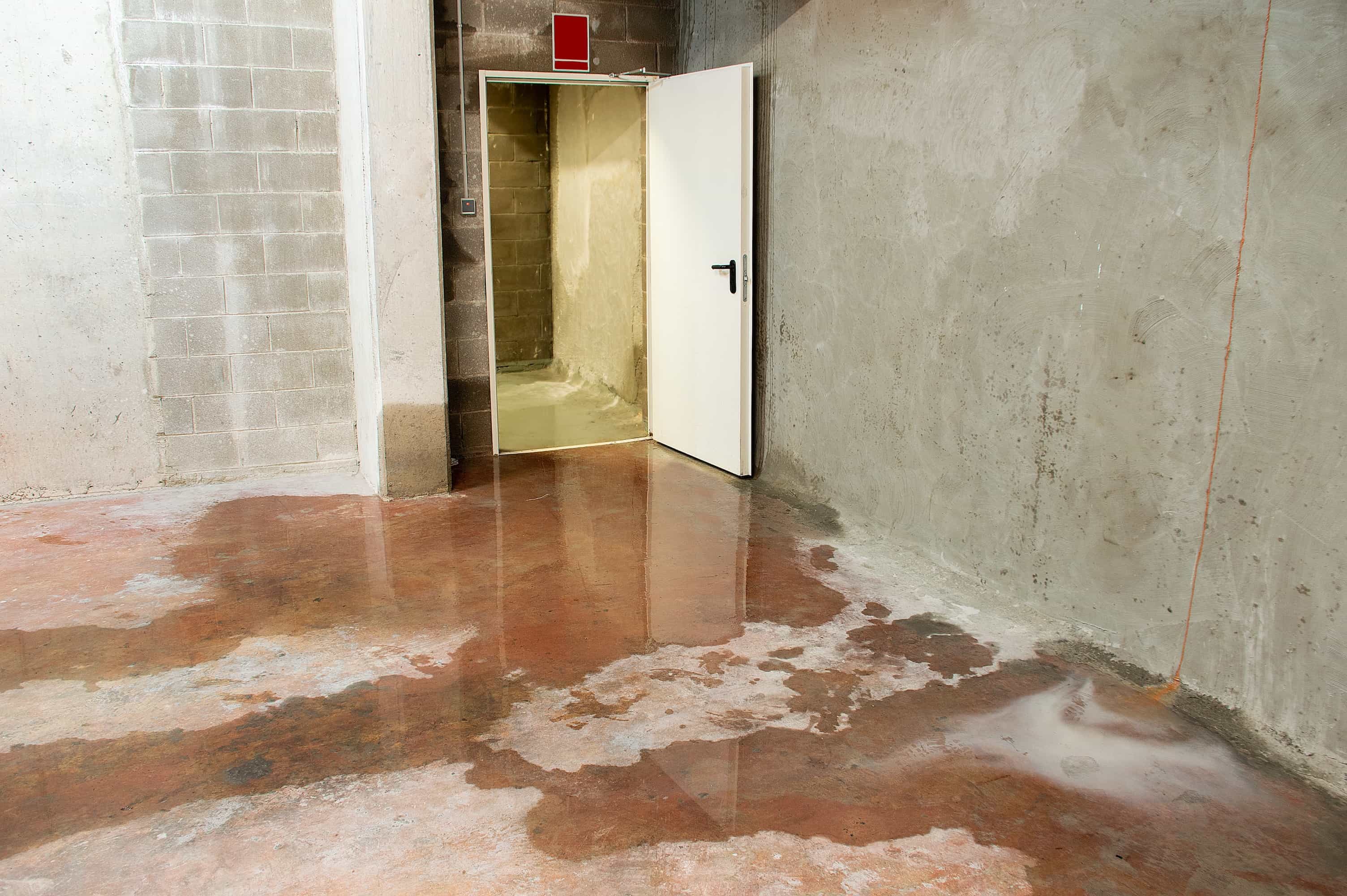
Overland flood coverage — the protection that responds when water enters a home from rising rivers, snowmelt runoff, or overwhelmed drainage systems — is not included in standard Canadian home insurance policies. It is available as an add-on endorsement from most insurers, but it must be purchased separately. A survey of Canadian homeowners found that 30% did not realize overland flood coverage was an add-on rather than a default inclusion, and only about half of policyholders currently carry it.
Sewer backup coverage is a separate endorsement that protects against water entering a home through backed-up storm or sanitary sewers — a common scenario during rapid snowmelt when municipal systems are overwhelmed. It is distinct from overland flood protection, and the two can be purchased independently.
Yukon's own flood preparedness guidance is unusually direct on this point. The territory's preparing-for-a-flood page explicitly states that sewer/septic backup and overland or groundwater flooding are "typically add-ons available at extra cost." Greg Blackjack, director of Yukon's Emergency Measures Organization, reinforced the same message publicly: overland or groundwater flooding coverage may be an add-on that requires extra cost.
A National Pattern Is Forming
Yukon's advisory does not exist in isolation. It is the fourth distinct Canadian region flagged for elevated spring flood risk in March 2026. Ontario and Manitoba were first: TRCA warned on March 22 that snowpack across Greater Toronto Area watersheds is carrying more water than 2025, while Manitoba rated five major river systems at moderate flood risk. Atlantic Canada followed on March 23, when the Insurance Bureau of Canada issued a spring flood readiness advisory as River Watch programs activated in New Brunswick. British Columbia had already been dealing with an atmospheric river event combined with deep snowpack since mid-March. And now Yukon, with four communities flagged based on well-above-normal snowpack and an unfavourable spring weather forecast.
The common thread is snowpack. Winter 2025–26 produced above-normal snowfall across much of the country, and the seasonal forecast describes the same pattern nearly everywhere: a cold, wet spring delaying the melt, followed by a warmer shift that releases stored water rapidly. Snowmelt runoff floods are the most common type of flooding in Canada, and the conditions that produce them are now present from British Columbia to the Atlantic coast and into the northern territories.
The Insurance Gap Is the Real Story
Across every one of these advisories, officials are telling homeowners the same thing: check your insurance. The reason is consistent, and it is not a minor administrative detail.
Overland flood coverage — the protection that responds when water enters a home from rising rivers, snowmelt runoff, or overwhelmed drainage systems — is not included in standard Canadian home insurance policies. It is available as an add-on endorsement from most insurers, but it must be purchased separately. A survey of Canadian homeowners found that 30% did not realize overland flood coverage was an add-on rather than a default inclusion, and only about half of policyholders currently carry it.
Sewer backup coverage is a separate endorsement that protects against water entering a home through backed-up storm or sanitary sewers — a common scenario during rapid snowmelt when municipal systems are overwhelmed. It is distinct from overland flood protection, and the two can be purchased independently.
Yukon's own flood preparedness guidance is unusually direct on this point. The territory's preparing-for-a-flood page explicitly states that sewer/septic backup and overland or groundwater flooding are "typically add-ons available at extra cost." Greg Blackjack, director of Yukon's Emergency Measures Organization, reinforced the same message publicly: overland or groundwater flooding coverage may be an add-on that requires extra cost.
Tip
When calling your insurer, ask three specific questions: Does my policy include overland flood coverage? Is sewer backup included or available as an endorsement? What is my deductible for a water damage claim? These three questions surface most coverage gaps in under ten minutes. Adding or modifying coverage typically cannot be done once a flood warning is active, so the time to call is now — not when water is at the door.
The broader context reinforces the urgency. Insured catastrophic losses in Canada now routinely exceed $2 billion annually, most of it from water-related damage. Those losses are already reshaping the market — Canadian homeowners are seeing rising premiums, higher deductibles, and tightening coverage in flood-prone areas. The federal government is examining options for a national residential flood insurance program through a public-private partnership, but that program does not exist yet. In the meantime, homeowners are responsible for verifying their own coverage.
Advertisement
What Homeowners Should Do Now
The readiness actions that Yukon's EMO and the Government of Yukon's flood preparedness guidance are recommending apply universally. They are not Yukon-specific advice — they are the same steps that conservation authorities, provincial emergency management organizations, and the Insurance Bureau of Canada recommend across the country every spring.
Property drainage: Clear eavestroughs, downspouts, and gutters. Extend downspouts at least 1.5 metres away from the foundation. In winter, clear snow 1 to 1.5 metres away from the foundation and remove ice dams to allow water to flow away from the building. Keep driveway culverts and yard drains free of debris.
Basement risk reduction: Ensure sump pumps and backwater valves are in working order and tested. Confirm basement floor drains are clear. Elevate appliances, important documents, and valuables off basement floors on blocks or shelving. Apply weather sealant around basement windows and doors.
Insurance verification: Review your policy for overland flood and sewer backup coverage. Call your insurer to confirm what is covered and what your deductible would be. Do this before any flood warning is issued, not after — coverage changes are typically unavailable once an event is imminent, and insurance costs are already rising in flood-prone areas across the country.
Emergency preparedness: Create a household emergency plan and assemble a 72-hour emergency kit. Know where your electrical panel, water shut-off valve, and fuel shut-offs are located. Secure or relocate outdoor equipment, vehicles, and recreational gear out of low-lying areas.
Advertisement
What to Watch Next
The Yukon government will release a full Spring Flood Risk Assessment in mid-April, incorporating April 1 snow survey data and updated ice thickness measurements. That assessment will provide a clearer picture of whether the Klondike Valley's ice jam risk and Southern Lakes' conditional flood potential are escalating or stabilizing. Homeowners in flagged areas can monitor real-time conditions through the territory's Flood Hub.
For Canadian homeowners outside the Yukon, the signal is the same one that has been building all month: spring 2026 is not a typical year. The snowpack is loaded, the weather pattern favours rapid melt, and the insurance gap means the financial consequences of flooding fall disproportionately on homeowners who assumed they were covered. If you are unsure whether your property sits in a mapped flood zone, NRCan's updated flood map inventory is a practical starting point. The preparation window is measured in weeks, not months.
Stay on top of Canadian homeowner news
About the Author
Ryan May
Senior Contributor / Founder
Ryan is the founder of Homeowner.ca and a proud Canadian homeowner based in Guelph, Ontario. Over his 25-year career in digital publishing, he has focused on transforming complex information into clear, practical guidance that helps people make confident, well-informed decisions.